


What is Remote Sensing?
In rangeland management, remote sensing is a way of getting detailed information about land from a distance, typically from aircraft or satellites. Most sensors collect data by detecting the sunlight that is reflected from the earth and plants. Since each object reflects sunlight differently, we can tell what is on the ground by the energy that bounces back to the sensor.
The method that you use for detection determines the level of detail that you see. There are tradeoffs between covering large areas, getting high detail, and frequent updates. Maps that are updating data frequently, or covering large areas-like Google Maps, may not get as high a resolution as an individual flight that is only trying to map your ranch. As many of you have noticed, Google Maps only updates its map imaging every few years.

Satellites, flights, and even drones can be used for remote sensing.
With Remote Sensing, you can monitor your pastures from home.
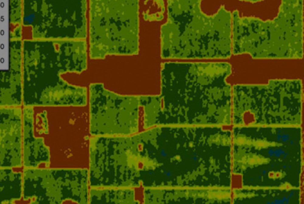
Ranchers often use remote sensing to understand what is really happening on the ground. The Normalized Difference Vegetation Index (NDVI) is one of the most used metrics because it can give you an estimate of the live green vegetation on your ranch. It has been used to estimate crop yields, pasture performance, and even rangeland carrying capacities. With remote sensing, you can avoid overgrazing, and go into the season with a good estimate of what your stocking density should be based on your actual available forage, saving you time and money.

NDVI provides a visual display of the vegetative cover on your entire ranch with numbers to help you estimate your actual available forage for the season. You can even track invasive species.